Опубликован: 01.11.2011 | Доступ: свободный | Студентов: 1424 / 63 | Оценка: 3.84 / 3.44 | Длительность: 15:38:00
Специальности: Программист
Практическая работа 20:
Использование картографического сервиса (Silverlight)
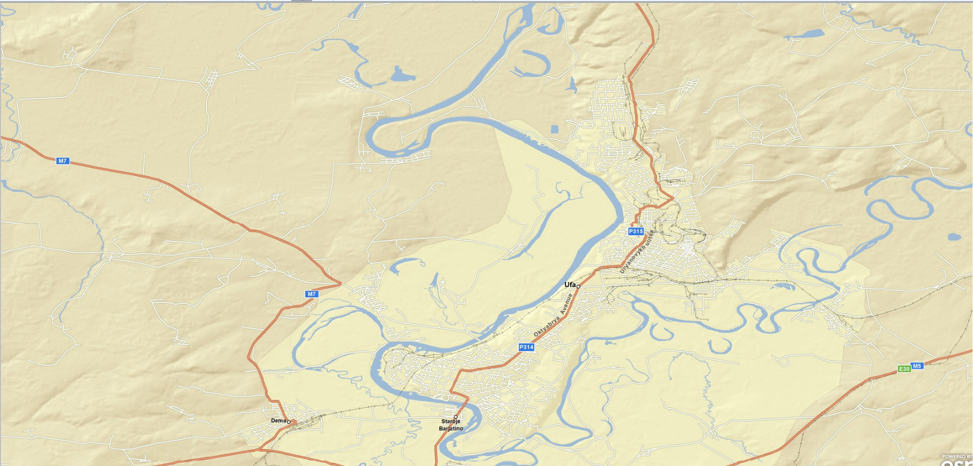
Упражнение 28.2. Карта с государственными границами
В данной работе мы создадим более сложную карту. Изначально на ней показаны государственные границы, при увеличении масштаба также становится виден рельеф местности.
Создаем приложение Silverlight p20_2. Повторяем действия из предыдущего упражнения.
Код xaml:
<UserControl x:Class="p20_2.MainPage"
    xmlns="http://schemas.microsoft.com/winfx/2006/xaml/presentation"
    xmlns:x="http://schemas.microsoft.com/winfx/2006/xaml"
    xmlns:d="http://schemas.microsoft.com/expression/blend/2008"
    xmlns:mc="http://schemas.openxmlformats.org/markup-compatibility/2006"
    mc:Ignorable="d"
    xmlns:esri="http://schemas.esri.com/arcgis/client/2009"
    d:DesignHeight="300" d:DesignWidth="400">

    <Grid x:Name="LayoutRoot" >

        <esri:Map x:Name="MyMap">
            <esri:ArcGISTiledMapServiceLayer ID="MyLayer"
                Url="http://services.arcgisonline.com/ArcGIS/rest/services/ESRI_StreetMap_World_2D/MapServer" />
        </esri:Map>

    </Grid>

</UserControl>
Результат:

Упражнение 28.3. Создание динамических слоев
Создаем проект Silverlight p20_3. Повторяем действия из предыдущего упражнения.
Код xaml:
<UserControl x:Class="p20_3.MainPage"
    xmlns="http://schemas.microsoft.com/winfx/2006/xaml/presentation"
    xmlns:x="http://schemas.microsoft.com/winfx/2006/xaml"
    xmlns:d="http://schemas.microsoft.com/expression/blend/2008"
    xmlns:mc="http://schemas.openxmlformats.org/markup-compatibility/2006"
    mc:Ignorable="d"
    xmlns:esri="http://schemas.esri.com/arcgis/client/2009"
    d:DesignHeight="300" d:DesignWidth="400">

    <Grid x:Name="LayoutRoot" Background="White" >

        <esri:Map x:Name="MyMap" >
            <esri:ArcGISDynamicMapServiceLayer ID="MyLayer"
                Url="http://sampleserver1.arcgisonline.com/ArcGIS/rest/services/Specialty/ESRI_StateCityHighway_USA/MapServer" />
        </esri:Map>

    </Grid>

</UserControl>
Результат:
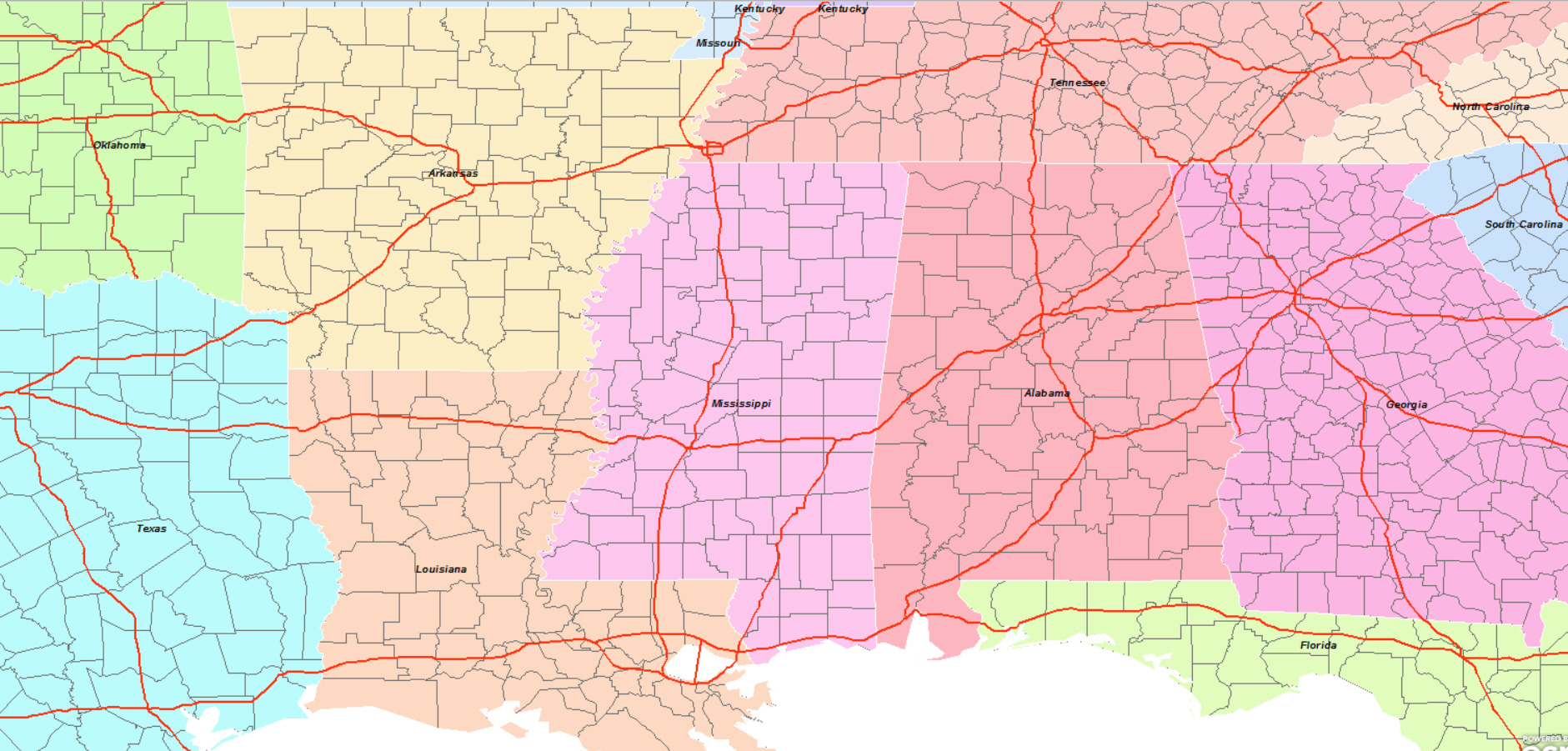
Упражнение 28.4. Динамические и Плиточные Слои
Создаем проект Silverlight p20_4. Повторяем действия из предыдущего упражнения.
Код xaml:
<UserControl x:Class="p20_4.MainPage"
    xmlns="http://schemas.microsoft.com/winfx/2006/xaml/presentation"
    xmlns:x="http://schemas.microsoft.com/winfx/2006/xaml"
    xmlns:d="http://schemas.microsoft.com/expression/blend/2008"
    xmlns:mc="http://schemas.openxmlformats.org/markup-compatibility/2006"
    mc:Ignorable="d"
    xmlns:esri="http://schemas.esri.com/arcgis/client/2009"
    d:DesignHeight="300" d:DesignWidth="400">

    <Grid x:Name="LayoutRoot" >

        <esri:Map x:Name="MyMap" Extent="-120,20,-90,60">
            <esri:ArcGISTiledMapServiceLayer ID="StreetMapLayer"
                Url="http://services.arcgisonline.com/ArcGIS/rest/services/ESRI_ShadedRelief_World_2D/MapServer"/>
            <esri:ArcGISDynamicMapServiceLayer ID="DynamicLayer" Opacity="0.6"
                Url="http://sampleserver1.arcgisonline.com/ArcGIS/rest/services/Specialty/ESRI_StateCityHighway_USA/MapServer"/>
        </esri:Map>

    </Grid>

</UserControl>
Результат:
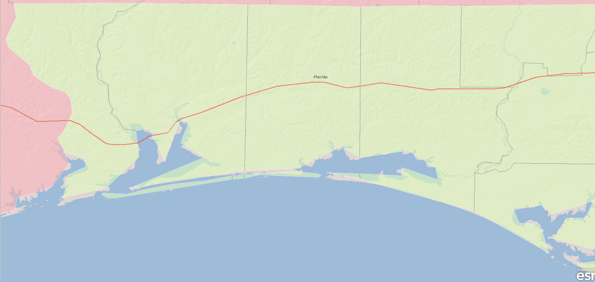
Упражнение 28.5. Список слоев
В данном приложении пользователь может также, как в программе ArcGIS, активизировать слои.
Создаем проект Silverlight p20_5. Повторяем действия из предыдущего упражнения.
Код xaml:
<UserControl x:Class="p20_5.MainPage"
    xmlns="http://schemas.microsoft.com/winfx/2006/xaml/presentation"
    xmlns:x="http://schemas.microsoft.com/winfx/2006/xaml"
    xmlns:d="http://schemas.microsoft.com/expression/blend/2008"
    xmlns:mc="http://schemas.openxmlformats.org/markup-compatibility/2006"
    mc:Ignorable="d"
    xmlns:esri="http://schemas.esri.com/arcgis/client/2009"
    d:DesignHeight="300" d:DesignWidth="400">

    <Grid x:Name="LayoutRoot" >

        <esri:Map x:Name="MyMap" Extent="-120,20,-90,60">
            <esri:ArcGISTiledMapServiceLayer ID="Street Map"
                    Url="http://services.arcgisonline.com/ArcGIS/rest/services/ESRI_ShadedRelief_World_2D/MapServer"/>
            <esri:ArcGISDynamicMapServiceLayer ID="State,City,Highway" Opacity="0.6"
                    Url="http://sampleserver1.arcgisonline.com/ArcGIS/rest/services/Specialty/ESRI_StateCityHighway_USA/MapServer"/>
            <esri:ArcGISDynamicMapServiceLayer ID="California" Opacity="0.4"
                    Url="http://serverapps.esri.com/ArcGIS/rest/services/California/MapServer" />
        </esri:Map>

        <Border Background="#995C90B2" BorderThickness="1" CornerRadius="5"
            HorizontalAlignment="Right"  VerticalAlignment="Top"
            Margin="20" Padding="5" BorderBrush="Black" >
            <ListBox x:Name="MyList" ItemsSource="{Binding ElementName=MyMap, Path=Layers}" Margin="3">
                <ListBox.ItemTemplate>
                    <DataTemplate>
                        <StackPanel Orientation="Horizontal" Margin="2">
                            <!--Layer visibility checkbox-->
                            <CheckBox IsChecked="{Binding Visible, Mode=TwoWay}" />
                            <!--Opacity slider-->
                            <Slider Minimum="0" Maximum="1" Width="30"
                                Value="{Binding Opacity, Mode=TwoWay}" Height="22" />
                            <!--Layer name-->
                            <TextBlock Text="{Binding ID, Mode=OneWay}" Margin="5,0,2,0" >
                            <!-- Tooltip on hover-->
                                <ToolTipService.ToolTip>
                                    <StackPanel MaxWidth="400">
                                        <TextBlock FontWeight="Bold" Text="{Binding CopyrightText}" TextWrapping="Wrap" />
                                        <TextBlock Text="{Binding Description}" TextWrapping="Wrap" />
                                    </StackPanel>
                                </ToolTipService.ToolTip>
                            </TextBlock>
                        </StackPanel>
                    </DataTemplate>
                </ListBox.ItemTemplate>
            </ListBox>
        </Border>

    </Grid>

</UserControl>
Листинг
.
Результат:
